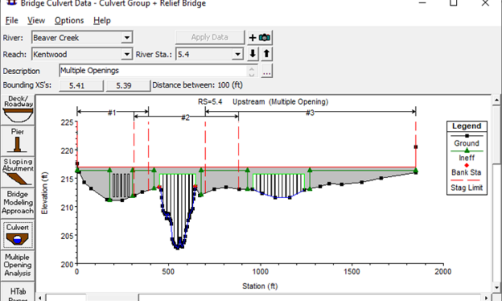
Multiple Opening Analysis
Did you know that if you have a bridge opening and one or more culverts at a single river crossing a Multiple Opening Analysis is required?

This webinar series will be led by Chris Goodell and Ben Cary. If you have any questions, please email us at hec-ras@kleinschmidtgroup.com.
Comments
Gary Wells
on June 17, 2022I am interested in HEC-RAS 2D modeling with mesh concept. I have experience in using 1D modeling in HEC-RAS 6.0. I am familiar with Ras Mapper using projection files and Terrain data for 1D modeling.
My background as a professional licensed civil engineer is with dams. I work in KY Dam Safety.
Do you offer HEC-RAS 2D modeling & boundaries with dam breach analysis approach in your August 18-September 22 classes? I would be interested if you do, please let me know. Thank you
Melissa
on June 28, 2022Hi, can you please help me out finding answers to the following:
Using HEC-RAS 6.2, from the Unsteady Flow Data dialog box, I created 2 rain gage stations over the model domain.
Following are my concerns:
1. When I click on the [Plot Stations…] button, it can be observed that a rectangular extent has been generated over the model domain. However, it is not clear what is the cell size used, how the number of rows and columns are computed and what buffer is taken while generating the rectangular extent.
2. In addition, if I click on the [Rasterization Parameters (Optional)] button, it allows the user to define the raster extent using several options.
However, it is not clear that after using these options, how the extent of the raster is computed. Say for example, if I select Fix Raster Parameters based on current Met Station Extent option, then it generates an additional extent.
However, it is not clear what is the cell size used, how the number of rows and columns are computed and what buffer is taken while generating the rectangular extent.
Kindly help me understand the functionality of Rasterization Parameters.
Add Your Comment